Webinar
Events
Calendar of Events
|
Monday
|
Tuesday
|
Wednesday
|
Thursday
|
Friday
|
Saturday
|
Sunday
|
|---|---|---|---|---|---|---|
|
0 events,
|
2 events,
-

This course provides a practical, hands-on introduction to RMC-BestFit, the USACE Risk Management Center's statistical analysis software for flood frequency studies. Participants will learn how to acquire and prepare hydrologic data, perform univariate and Bulletin 17C frequency analysis, and explore advanced modelling capabilities including point process, mixture, and composite distribution analysis. EVENT INFORMATION +… 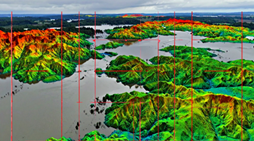
This course introduces participants to the rapidly evolving world of 3D geospatial data, with a clear focus on water management and hydrological analysis. Working with real‑world LiDAR, photogrammetry and drone‑derived point clouds, participants learn how to turn raw datasets into meaningful surfaces, models and visualisations that support evidence‑based decision making. Across three practical sessions, participants… |
0 events,
|
0 events,
|
0 events,
|
0 events,
|
0 events,
|
|
0 events,
|
0 events,
|
1 event,
Session #8 of the 2026 ‘Stormwater Fundamentals’ series, and explores the potential of constructed stormwater wetlands functioning as “ecological traps”. EVENT INFORMATION REGISTRATION HERE |
0 events,
|
0 events,
|
0 events,
|
0 events,
|
|
0 events,
|
1 event,
This course introduces participants to the rapidly evolving world of 3D geospatial data, with a clear focus on water management and hydrological analysis. Working with real‑world LiDAR, photogrammetry and drone‑derived… |
0 events,
|
0 events,
|
0 events,
|
0 events,
|
0 events,
|
1 event,
-
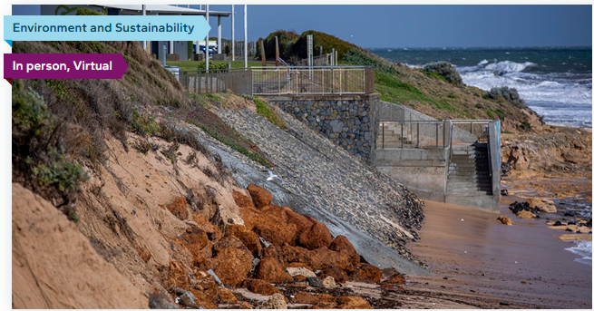
Local Government has an important role to play in responding to and managing the ever-increasing impacts of increasing temperatures, natural disasters and sea level rise. If ignored, the effects of… |
1 event,
This course introduces participants to the rapidly evolving world of 3D geospatial data, with a clear focus on water management and hydrological analysis. Working with real‑world LiDAR, photogrammetry and drone‑derived… |
0 events,
|
1 event,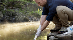
Environmental DNA (eDNA) is transforming how we understand and monitor aquatic ecosystems, offering a powerful, non‑invasive way to detect species and assess biodiversity. This course introduces participants to the science… |
0 events,
|
0 events,
|
0 events,
|
|
0 events,
|
0 events,
|
0 events,
|
0 events,
|
0 events,
|
0 events,
|
0 events,
|
|
0 events,
|
0 events,
|
0 events,
|
0 events,
|
0 events,
|
0 events,
|
0 events,
|